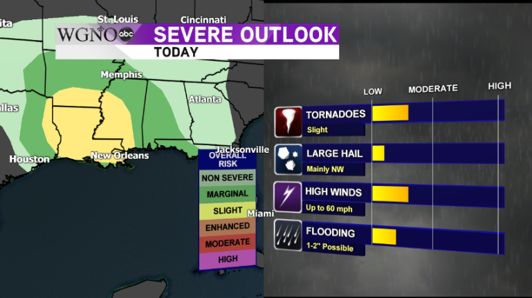
NEW ORLEANS – A developing low pressure system over Oklahoma is causing showers and storms to develop ahead of it and impact our area today. Some of these storms could be on the stronger side bringing with them the possibility of severe weather.
A warm front pushing through the northern Gulf Coast has already brought heavy rain and thunder across Louisiana and Mississippi. While the morning storms have stayed below severe limits, there is still the possibility for damaging straight-line winds and even an isolated tornado to develop this afternoon.

The rain will arrive in waves throughout the day and we’ll see a break after the morning storms have rolled through. This will give temperatures a bit of time to recover and make their way into the middle 70s for afternoon highs. This additional warmth plus more instability in the atmosphere will help lead to more rounds of storms this afternoon with the potential for severe weather.

Currently, the storm prediction center has our area under a slight risk for severe weather. We will continue to monitor the progress of this developing system and if any watches or warnings are issued, the WGNO Weather Team will update you on-air, online and on social media.
~Meteorologist Jason Disharoon


