
A spring-like afternoon will make for a nice day Tuesday ahead of a cold front moving in from the north. Most of the area will see low to mid 70s for through the evening. The cold front will push in around sunset with very little moisture to work with. Expect only a small shower or a few sprinkles.
The bigger story with this system will be the temperatures. While not a major arctic blast, it will feel quite a bit cooler through the rest of the work week. 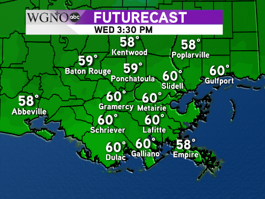 Temperatures by Wednesday afternoon will only be hovering around 60, and it may take a while to get to that point. Expect some breezy conditions Wednesday as well.
Lows by Thursday morning will be all the way down into the 30s. Most of the area should stay above freezing with low to mid 30s north and upper 30s to low 40s south.
Thursday afternoon will be even cooler though with mid 50s for highs.
Look for dry weather to continue through Friday before the next chance of rain on Saturday


