
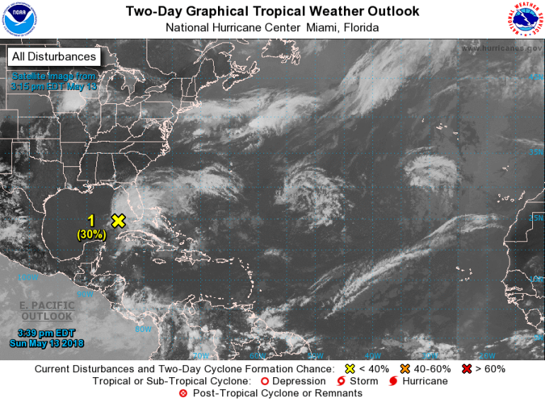
MIAMI, FL – The National Hurricane Center (NHC) issued a special statement on the disturbance entering the Gulf of Mexico Sunday afternoon.
The NHC gives the disturbance a 30% chance of tropical formation in the next 48 hours and a 40% chance of tropical formation over the next 5 days. This falls in the ‘low probability’ range.
A trough and low pressure system are moving into the Gulf from the region around Cuba and the Bahamas and is currently slowly moving to the north.
Even if tropical formation does develop, this system is expected to stay well to the west along the Florida Peninsula and Panhandle region. We may see a slight increase in thunderstorm chances from this system this week as the outer edge of this unorganized disturbance moves by.
Here’s the full text of the statement:
“A large are of cloudiness, showers and thunderstorms extending from western Cuba across the southeastern Gulf of Mexico, the Florida Straits, and much of the Florida Peninsula is associated with a broad surface low and trough interacting with an upper-level low. This system could acquire some tropical or sub-tropical characteristics while it moves slowly northward across the eastern Gold of Mexico during the next few days. Regardless of subtropical or tropical formation, this system will enhance rainfall across portions of Florida and the northeaster Gulf Coast during the next few days.”
We will continue to keep you updated on-air and online on this developing system.


