NEW ORLEANS – The newest and most technologically advanced weather satellite our country has sent back amazing views of the weather system that sent severe weather across the Great Plains and Southeastern U.S., including Louisiana and Mississippi.
GOES-R, which stands for Geostationary Operational Environmental Satellite – R Series, which was launched just last November and is still in its testing phase in orbit, sent back imagery in several wavelengths of this past weekends severe weather. Each wavelength looks at a different part of the electromagnetic spectrum, from visible light to infrared to ultraviolet and much more. The images that caught our eye though, are from Band 13, or the long-wave infrared wavelength.
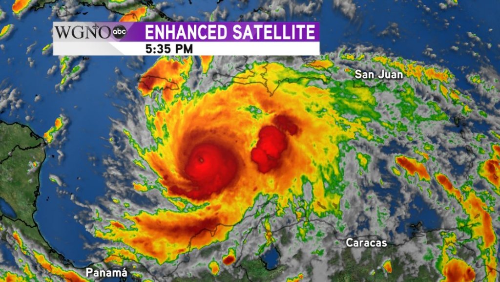
Long-wave infrared is primarily used to monitor clouds and storm intensity by measuring the temperature of the cloud tops. The colder a cloud top is, the stronger a storm likely is. You may be most familiar with infrared imagery when we show hurricane satellite images. The rainbow pattern used shows the colder cloud tops (which hold thunderstorms) as orange and red, while less cold cloud tops (they aren’t exactly warm) as light to dark blue and green as seen in the image below of Hurricane Matthew last October.
As you can see from the video at the top of the page, this weekend’s storm system had intense orange, red and even brown represented, marking where the most intense severe weather was found over the weekend. Over 13 people were killed as the storms barreled through. It is hoped that the newest technology on GOES-R will help meteorologists and forecasters be able to forecast and pinpoint severe weather more accurately and with greater advanced warning in an effort to prevent the loss of life due to severe weather.


