NEW ORLEANS (WGNO) — We are continuing to track an area of low pressure developing over the Gulf of Mexico that is leading to rough seas, coastal flooding and the potential for heavy rain.
The northern rain bands of the system are already affecting portions of the Louisiana Gulf Coast. Storm coverage is expected to become more widespread across the area on Wednesday as the low slowly moves northward.
Similar to some tropical systems, we may see bands of rain rolling over the same areas, which may lead to flooding in low-lying areas or locations with poor drainage.
Higher rainfall totals from this system will be farther south, closer to the Gulf Coast, where 3 to 4 inches of rain will be possible. Farther north, 1 to 3 inches of rain can be expected with isolated higher totals.
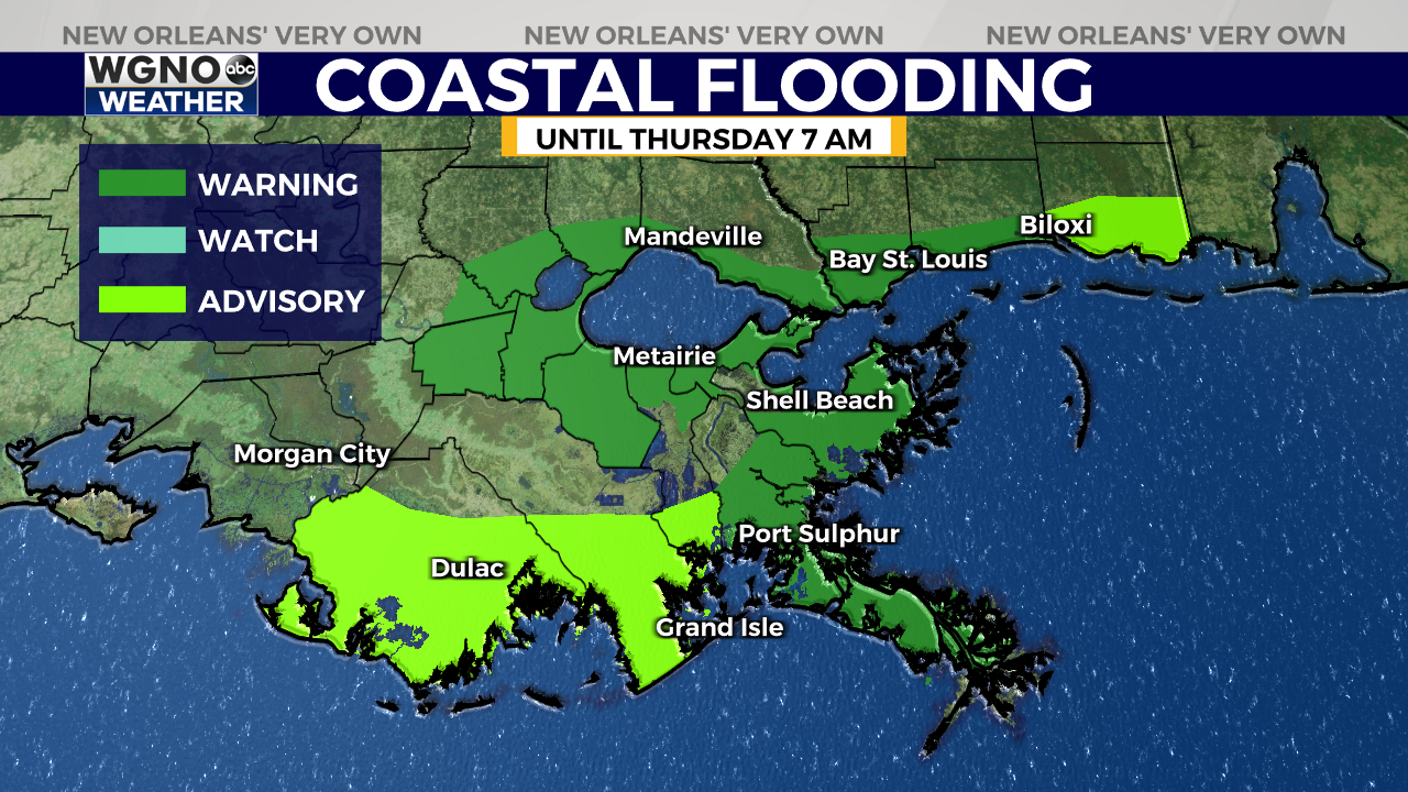
A Coastal Flood Warning is in effect until 7 a.m. Thursday for the Gulf Coast and area lakes where inundation of 1 to 3 feet can be expected.
This system looks like it will move out of the area on Thursday. Expect seas to calm once the low moves over land with drier weather returning by Friday. However, we will not remain rain-free for long. Another front looks to move through over the weekend elevating rain chances Saturday into Sunday.


