Good Morning, New Orleans! Sunday night into Monday morning’s cool front impact is leaving us today as a round of humidity returns with temperatues reaching upper 70s, feeling like low 80s! This is out ahead of yet another front approaching from the west early Friday.
Warmer weather returns Thursday and Friday with highs back in the 70s, but another cold front will bring in cooler temperatures for the upcoming weekend. Rain chances ramp up Friday out ahead of the front! Right now, timing appears to be late morning to early afternoon with eventual clearing.
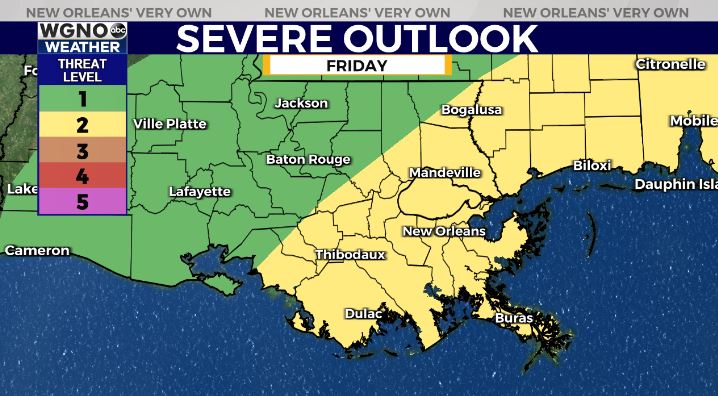
The Storm Prediction Center is issuing a Slight Risk (Level 2/5) for much of the viewing area with gusty winds and possible spin up tornadoes as main threats.
Once the front clears out, temperatures will drop considerably as we head into the weekend. High temperatures will struggle to get out of the low 50s on both Saturday and Sunday.


