Windy conditions are expected across the Gulf Coast late Tuesday.
A High Wind Warning has been issued until 6 a.m. Wednesday for sustained winds of 30 to 40 miles per hour with gusts up to 50 mph.
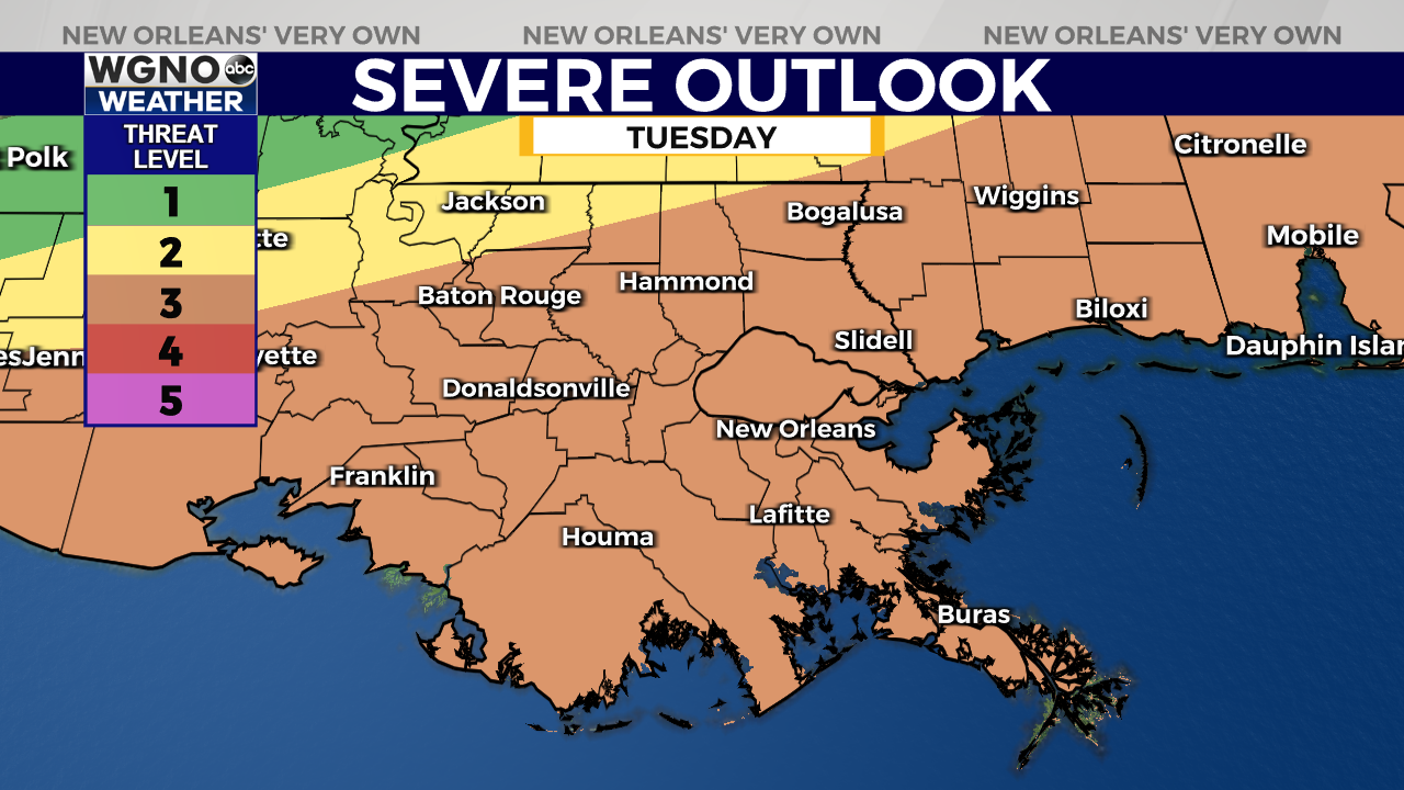
The strong southerly winds come ahead of a line of storms Tuesday night into early Wednesday morning. The Storm Prediction Center has placed most of Southeast Louisiana and South Mississippi under an “Enhanced Risk” for severe weather, which is threat level 3 out of 5 on their scale.
The main threat in any strong or severe storms that develop will be damaging wind gusts and tornadoes. The latest weather models show the line of storms moving through between 8 p.m. Tuesday and 2 a.m. Wednesday, with the heaviest storms likely around 11 PM for the New Orleans metro.
Breezy and cooler conditions are expected return by Wednesday afternoon. Temperatures will remain cool for the remainder of the week with highs in the 50s and 60s and overnight lows in the 30s 40s.


