
Rain has ended across the area Friday morning but with all the moisture lingering around we still have some mist and drizzle that is too light to show up on radar. This trend will continue through early afternoon before ending later today. No additional rainfall accumulations will occur today. Temperatures will be fairly steady in the mid to upper 60s.
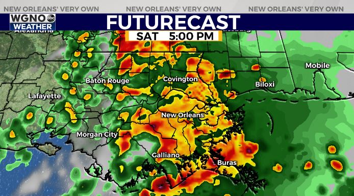
The last part of the storm system comes through on Saturday. That means another round of rain and storms through the afternoon. Some of those storms could be on the strong side. Once again we have a level 1 risk of severe weather from the storm prediction center. Locally heavy rain will be possible as well. Temperatures will be mild again.
Look for a clear day to end the weekend on Sunday with sun and low 70s.


