Heading into Monday, rain may impact your afternoon plans once again. Expect skies to start out partly cloudy tomorrow morning with scattered storms developing in the early afternoon.
Any storms that develop may produce locally heavy downpours which may lead to minor street flooding in areas that are low-lying or may have poor drainage. Rain will come to an end by the evening as we lose daytime heating.
Tuesday through Thursday, it looks like we will see a mix of sun, clouds, and showers. Rain chances drop to just 30 to 40 percent through the middle of the week to account for isolated to widely scattered showers.
In the tropics, the National Hurricane Center is monitoring several disturbances, but none of them are an immediate threat to the United States. A tropical wave in the Caribbean, a wave over the northern Atlantic, and a wave near Africa all have low development chances through the next five days.
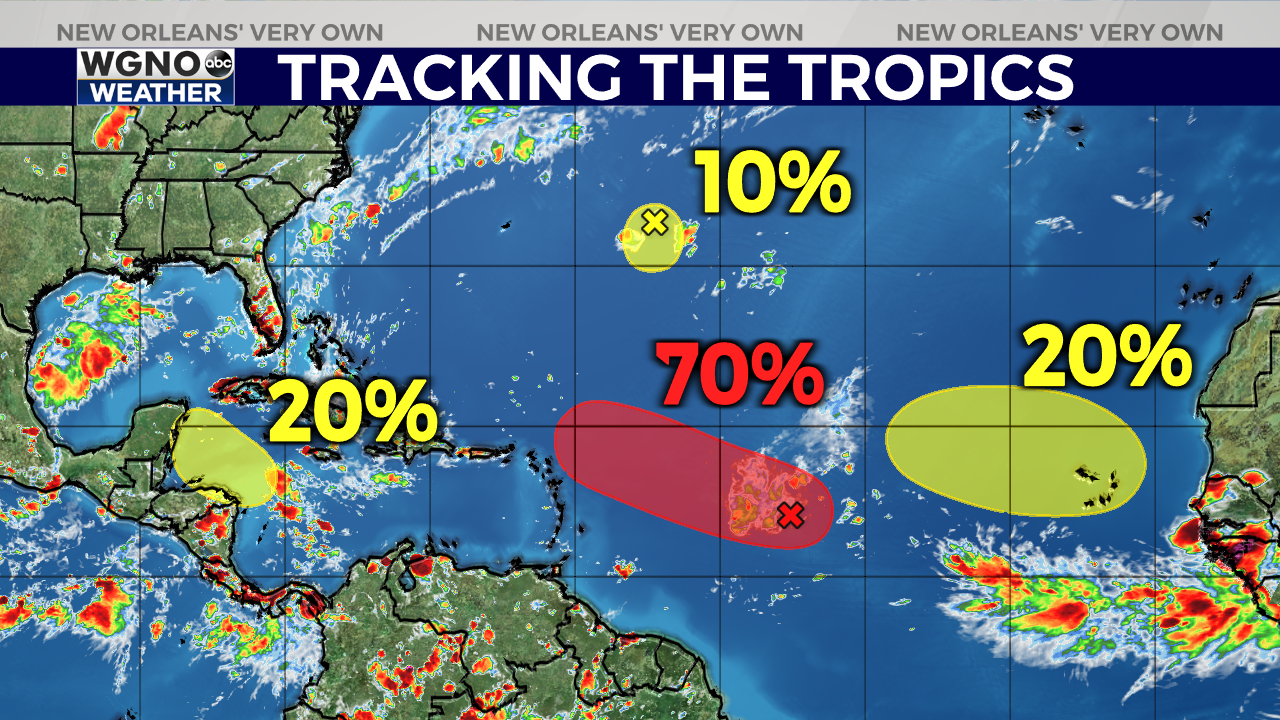
The best shot for development is associated with a tropical wave over the Central Atlantic. This system has a 70 percent chance of formation and will likely become a tropical depression by mid-week as it moves north of the Lesser Antilles. If it becomes a named storm, the next name on the list is Danielle.


