Good Morning, New Orleans! Showers and storms are a bit less widespread today, which means only a few wild downpours continue. As we typically see, the best chance will be along the coast and I-10 corridor with several daytime heating storms near the New Orleans area to come. Localized street flooding is certainly possible across a number of southshore locations.
Some localized heavy downpours can be expected around the peak of daytime heating, mainly between 1 p.m. and 5 p.m. The best chance for rain will be along and south of the I-10 corridor.
There’s a better chance for widespread rain on Thursday and Friday, as tropical moisture from the Gulf of Mexico flows into the area. Over the next five days, around 2 to 5 inches of rain can be expected, which may lead to minor flooding in some locations.
With strong onshore wind flow, there is also the potential for coastal inundation of 1 to 2 feet at high tide. through the middle of the week. A Coastal Flood Advisory is in effect through Thursday afternoon.

This pattern will continue through much of the week. Expect most of the rain to diminish at night but then redevelop each afternoon with the daytime heating. Temperatures will be topping out in the mid to upper 80s through Friday thanks to rain and cloud cover.
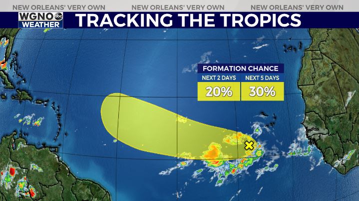
After a lull in activity for several weeks, it appears a new system may soon form in the tropics.
Forecasters at the National Hurricane Center are watching a tropical wave in the Atlantic Ocean, near the coast of Africa. The NHC gives the system a 30 percent chance of formation over the next five days.

Models show the wave possibly organizing and strengthening over the next few days as it moves generally westward. If it becomes a named storm, the next name on the list is Danielle. Right now, this is hardly guaranteed.
Beyond a few days out, it is still too early to tell where this system will go or how it will evolve. This tropical wave is still more than 3,000 miles away from the United States, so there is plenty of time to watch if and how it develops.


