Another strong storm system will move across the area during the evening on Wednesday and bring with it another threat of severe storms. Like last week very windy conditions will also move in ahead of the line of storms.
We have a rare High Wind Warning issued for the southern half of the area Wednesday.
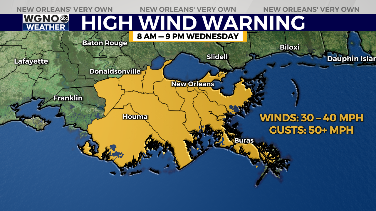
Winds could gust into the 50s at times with widespread gusts in the 40s likely through the day. Keep in mind this is ahead of the line of storms and not related to any potential severe winds that may move through with the storms. Those winds could get over 60-70mph.

We have another level 4 risk of severe weather for the northern half of the area with level 3 to the south. The most widespread threat is that strong wind gust potential in the line. However isolated tornadoes will once again be possible, especially in any cells that form due to the line breaking up.
Dryer weather will move in through the end of the week with another chance for some showers through the first half of the day Saturday.


