Winds are picking up out of the south and will continue to do so throughout the day Tuesday ahead of our next weather system.
Expect winds of 20 to 30 miles per hour with gusts up to 45 mph out of the south and southeast, which will help bring in warmer, more humid air. A Wind Advisory is in effect from 9 a.m. until 9 p.m.
We are continuing to monitor the development of our next storm system as models show it bringing heavy rain and severe storms to Louisiana and Mississippi.
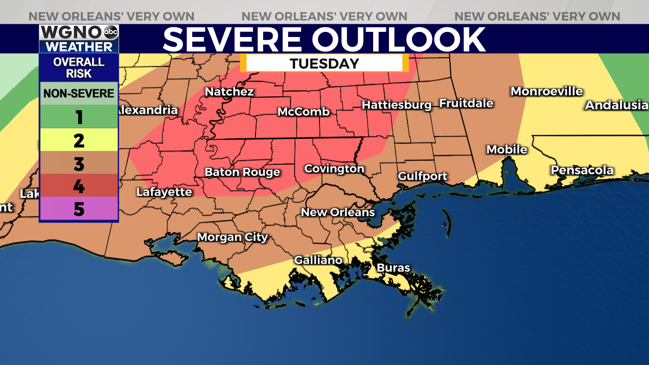
A large area near the Louisiana and Mississippi state line has been placed under a “Moderate Risk” for severe weather, which is threat level 4 out of 5 on the Storm Prediction Center’s scale. Just to the south, most of the Mississippi Gulf Coast and New Orleans metro have been placed under an “Enhanced Risk” (threat level 3 out of 5).
Areas included in the “Enhanced Risk” should expect 1-2 inches in rainfall, storms with some damaging wind gusts, and the possibility of some brief, weak, spin-up tornadoes.
Areas included in the “Moderate Risk” should expect 2-4 inches in rainfall, storms with wind gusts in excess of 60 mph, large hail, and the possibility of some long-track tornadoes.
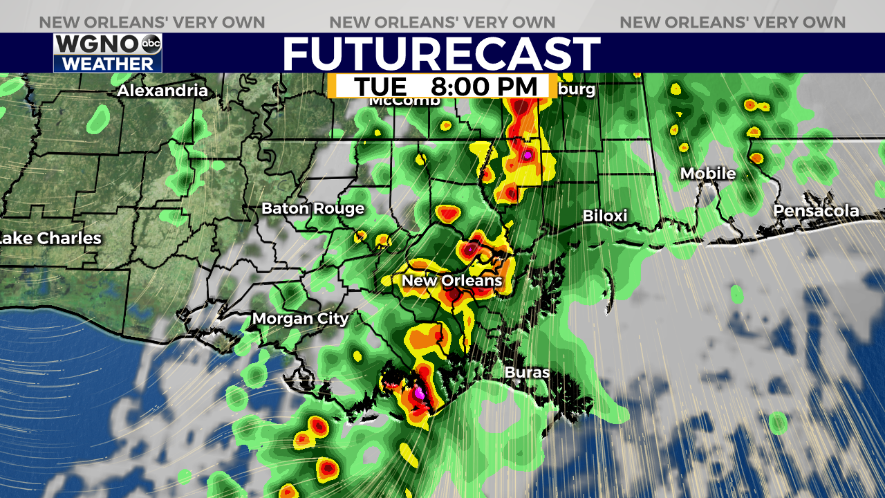
Our latest models show that showers and a few storms will be possible starting at around 3 p.m. ahead of the main squall line.
It appears the bulk of the storms will move through between 5 p.m. and 10 p.m., with the heaviest storm activity right around sunset.
Be sure to secure loose outdoor items before the wind picks up! The National Weather Service encourages everyone to have a safety plan in place and to have multiple ways to receive severe weather alerts.


