NEW ORLEANS (WGNO) – We’re only three days into November, and we’ve already set or tied the record high each and every afternoon this month.
Combined with the end of October, our string of record highs now stands at 6. But there is relief on the way.
A cold front sliding through the area overnight will offer some relief and folks on the Northshore, where temperatures will actually dip back into the upper 40s to lower 50s this weekend. Thankfully, it looks like this string of record highs will come to an end.
Temperatures on Friday should be a few degrees cooler, only topping out in the lower 80s. Factored in with drier air behind the front and there will be a noticeable cool down in the air. Thankfully that will last throughout the weekend and into Monday.
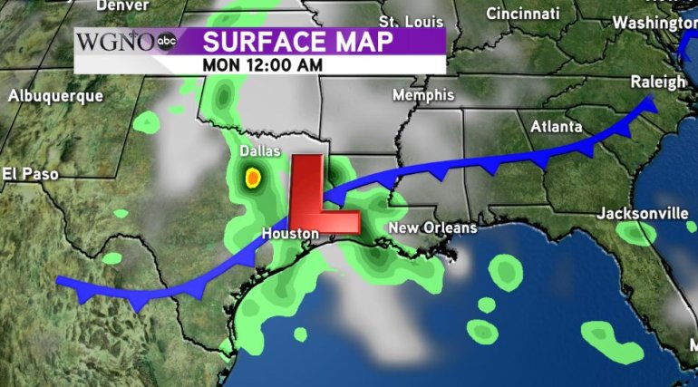
By Monday evening, another disturbance will approach the area, bringing with it our best chance of rain in quite sometime. Unlike the past few cold fronts that have moved through, models are hinting that an area of low pressure will develop over Texas helping to enhance the flow of moisture into our area.
It looks like our best chance of rain will be Tuesday, with clouds and scattered showers moving in. The moisture should linger around enough to continue our decent chances of rain Wednesday and Thursday as well before we begin to clear out heading into the weekend after that.
With all of our viewing area experiencing drought conditions, any sign of extended moisture could give us the rain we need to break free from the dry spell that has gripped the region for the last month and half.


