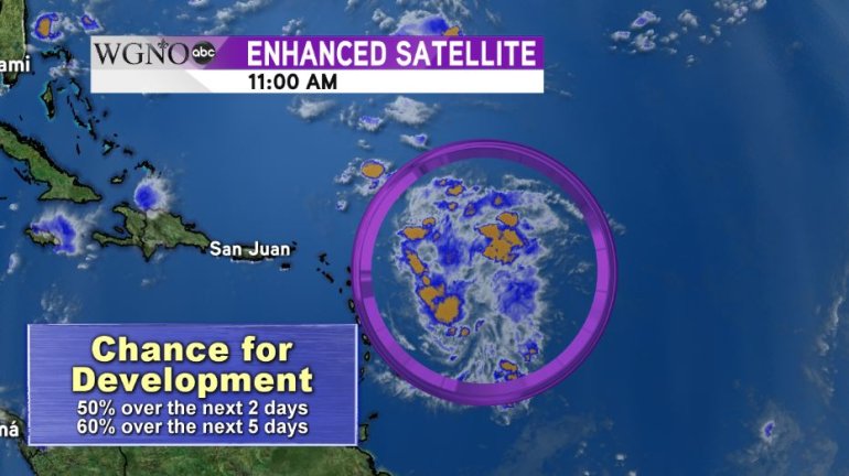
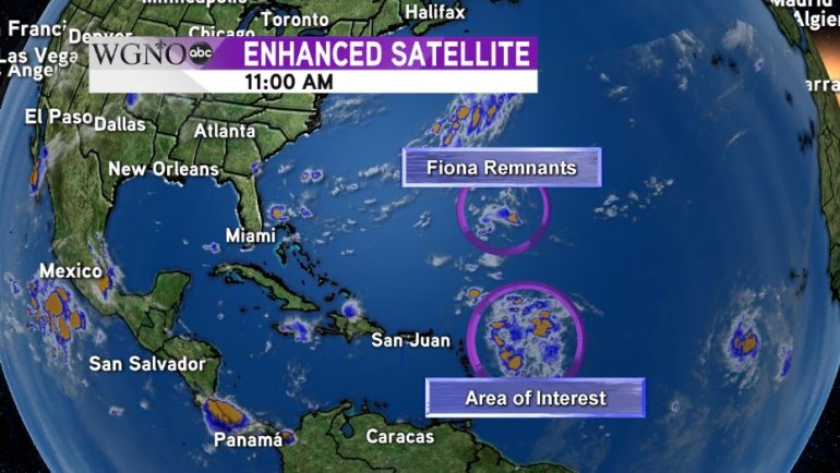
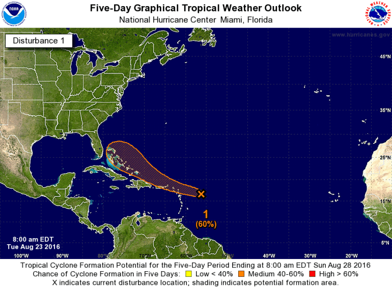
NEW ORLEANS (WGNO) – The tropical wave centered about 800 miles east of the Antilles Islands continues to move into more favorable waters and atmospheric conditions. The National Hurricane Center in Miami, Fla. is giving the wave a 50% chance of development into a tropical system within the next 48 hours.

The big questions on everyone’s minds are: where is it going and how strong will it be?
One thing to remember is that this wave does not yet have a well-defined, closed circulation. While that means it’s technically not a tropical depression or a tropical storm, more importantly, it means the models do not have a centralized point to start their analysis from.
Without this point, the models are essentially guessing a starting spot and that leads to errors in the forecast track.
But here’s what we do know
A large area of high pressure to the north of the wave is keeping it on a west-northwestward path that should bring it over the much warmer waters of the Southern Bahamas. How warm? The waters north of Hispaniola and the Bahamas are around 84° and 86ºF, well above the minimum needed to fuel tropical development.
Furthermore, the warm water is relatively deep giving any system that goes over it plenty of fuel. While this would typically be perfect for rapid intensification once it arrives, there’s one wrench in the cog that makes how strong the system will be more uncertain.
That’s the Madden-Julian Oscillation (MJO). A complicated term so let’s simplify. When the MJO is in an unfavorable phase for the tropical Atlantic, as it is now, the air is generally sinking across the area as a whole. You need rising air for development, so this could decrease the chances for rapid intensification.
So as for how strong, we are in a wait and see the pattern, especially given the waves large size.

As for where is it going, most models are fairly certain the wave will enter the warm waters of the Bahamas. Beyond that, it remains to be seen how the remnants of Fiona and another trough exiting the U.S. coastline will interact with the wave.
The trough represents a weakness in the ridge currently steering the wave off to the west. The more this trough interacts, the more likely the storm will make a temporary veer to the north. The northward turn would most likely only be temporary, though, and the wave could resume its westward motion towards the west.
As for Fiona’s impacts, that also remains to be seen as to how it interacts with the trough as well. Overall there is a high degree of uncertainty in the path of the storm beyond the Southern Bahamas.

This being said, all interests on the U.S. Atlantic coast from Southern Florida to the Carolinas should take a keen interest in this disturbance over the next week.
This wave has a very large, broad circulation. Even if it doesn’t develop quickly into a tropical system, the potential for widespread flooding in the Bahamas and the U.S are possible in areas where the disturbance eventually ends up.
One last thing to keep in mind: this tropical wave is still far out to sea. Any impacts to the U.S. Coast are still about a week away, and a lot can change in those seven days.


